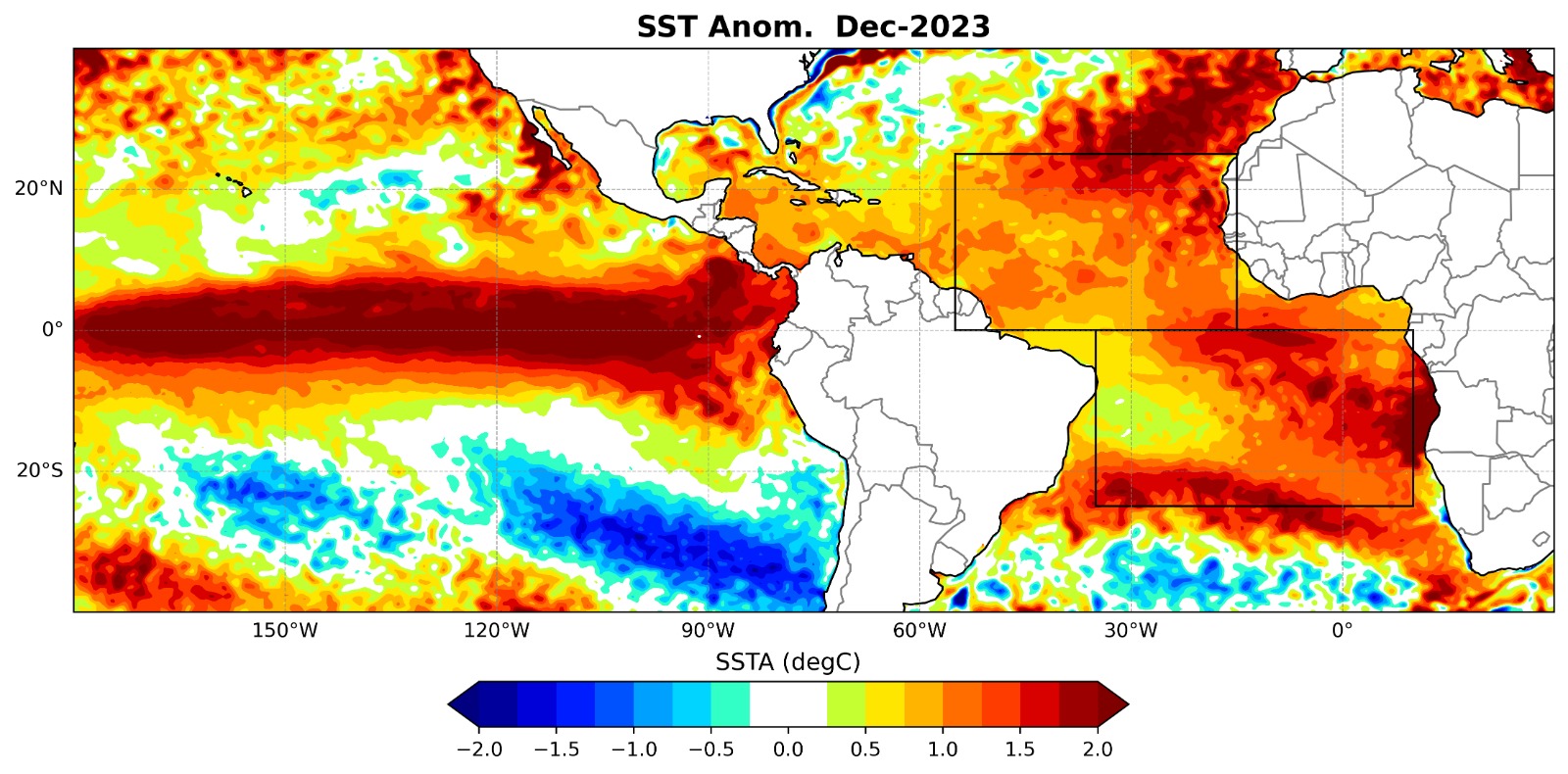
The surface of the tropical Atlantic was warm at the beginning of 2024, both north and south of the equator, as shown in fig. 1. The warm sea surface is consistent with weak zonal winds and an associated reduction in latent heat loss from the surface of the ocean.
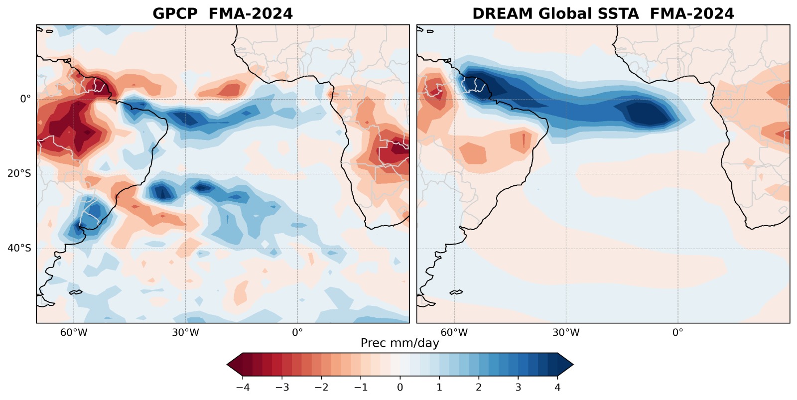
Warm anomalies north and south of the equator are normally associated with opposite rainfall patterns over Northeastern Brazil, with dry conditions when it is warm in the north and wet when it is warm in the south. El Niño conditions are also conducive to a dry Nordeste. However, wet conditions were observed over the eastern tip of Nordeste Brazil in early 2024 and it was dry further north. This suggests an important role for the southern tropical Atlantic.
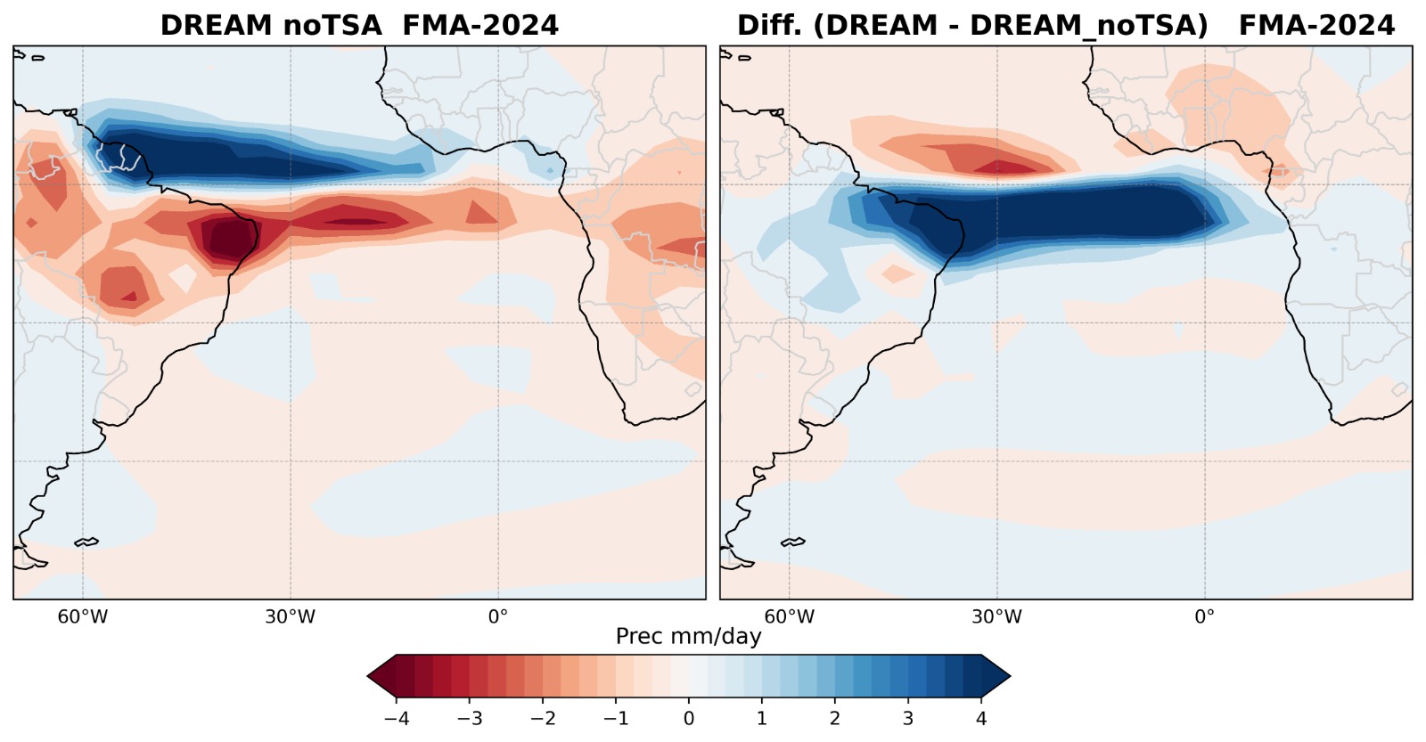
An ensemble forecast was made using the DREAM simple GCM, forced by the observed SSTA. It produced a similar pattern, although with a slight northward shift, as shown in fig 2.
This work is being prepared for publications by Aubains Hounsou-Gbo (LABOMAR-UFC Fortaleza).